LOCATION:
Cleator, Arizona
United StatesSIZE:
2,437 Acres • 133 Claims
12 Former MinesRESOURCES:
Gold, Sliver
& Copper
Project Overview
Strategically located in the historically active Volcanogenic Massive Sulfide “VMS” and Gold exploration and production jurisdiction, of Yavapai County Arizona.
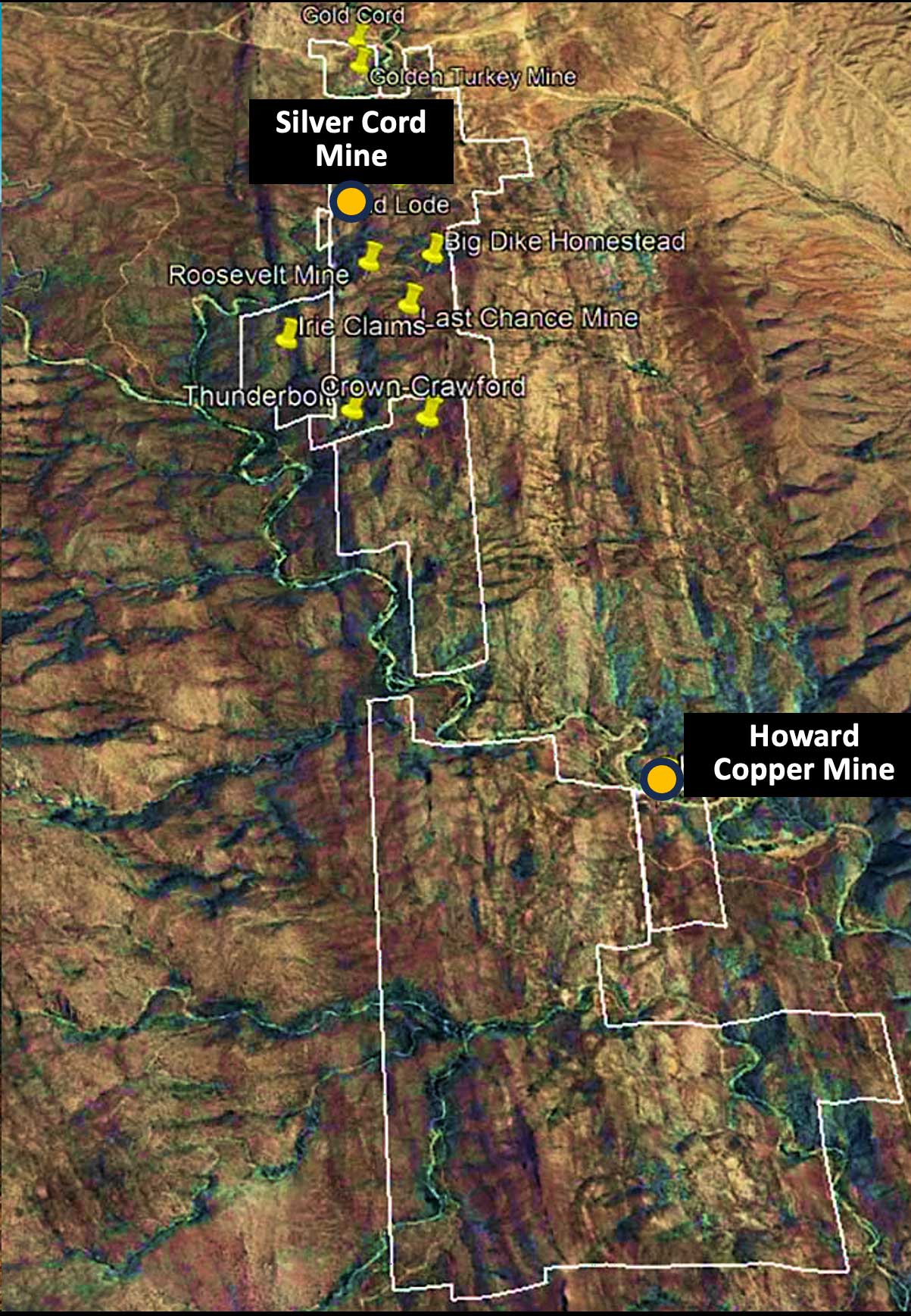
The Silver Cord Project is located near Cleator, Arizona in the Black Canyon mining district Yavapai county, part of the Prescott National Forest. The Silver Cord Project consists of 133 contiguous mining claims covering 2,437 acres (986 ha.). The properties are easily accessible with 4-wheel drive via Interstate I-17 just 90 miles north of Phoenix. There are 12 former operating mines on the Silver Cord land package. There are also 60 vein-hosted base and precious metal mines within a 150 km radius.
The Silver Cord Project represents an early-stage exploration opportunity targeting VMS and intrusive related base and precious metal mineralization. The original Silver Cord mine was discovered in 1877 and operated as a gold-silver, copper, lead-zinc mine from 1928-1930. In the early 20th century, the focus shifted to copper exploration when several copper deposits were discovered, including the United Verde Copper mine in Jerome (produced 30 Mt at 5% copper from an open pit and 4 Mt at 10% copper underground). The Kay mine operated by Arizona Metals is approximately 16 kms south of the project area, and its VMS deposit is on trend with regional features, heightens the potential of a similar deposit at the Silver Cord project area.
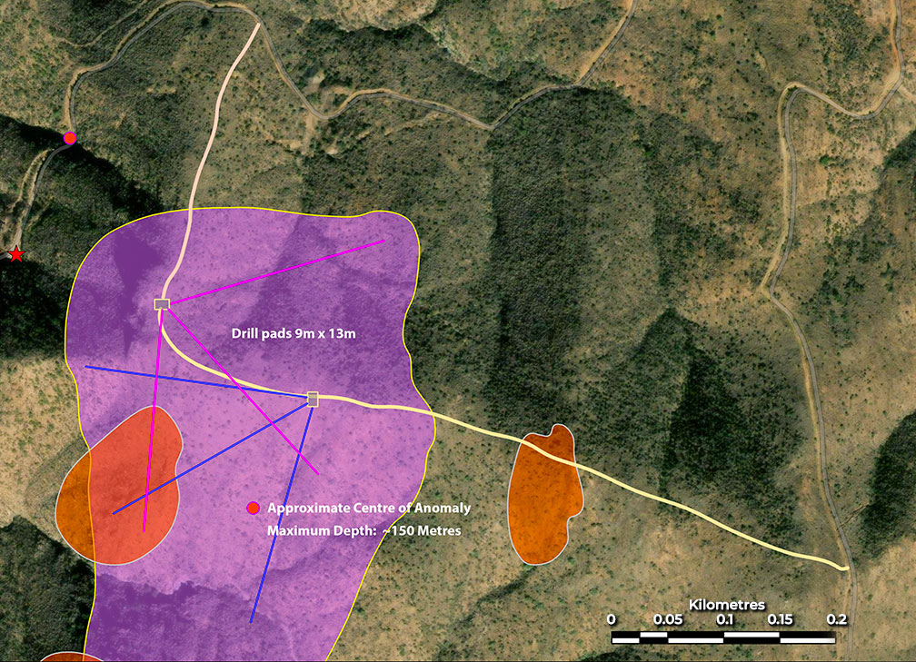
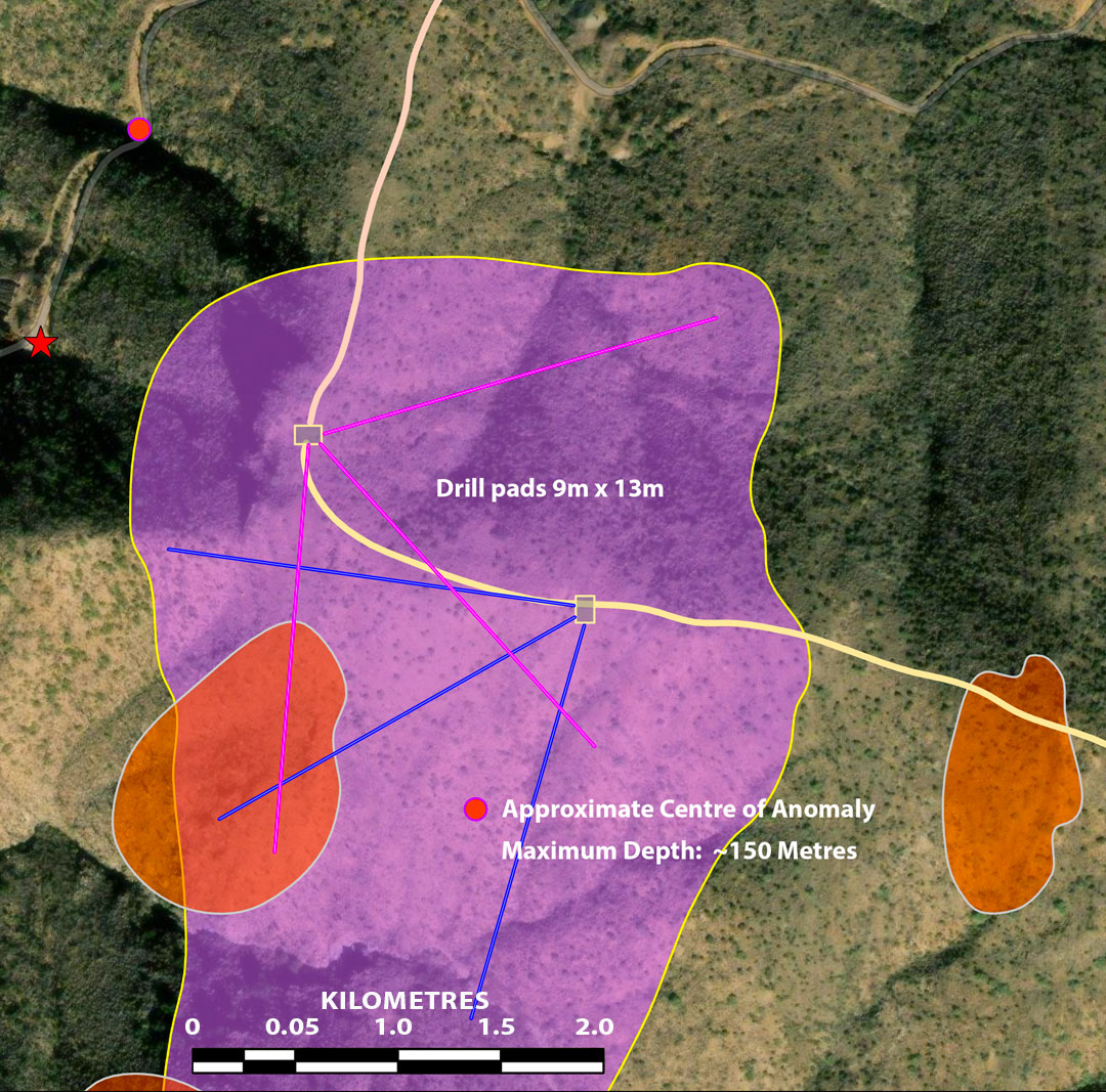
In 2022-23, Silver Cord LLC commissioned Rangefront Mining Services to complete a series of sampling programs, geophysical surveys and exploration field work. The objective of these programs was to investigate the property for potential VMS mineralization similar to that currently being developed at the Kay mine. Rangefront collected 228 surface soil samples, 14 samples from underground workings, conducted 8 geological traverses, flew 126 line km of UAV magnetometer survey and completed 5.75 kms of Controlled-Source Audio-Magneto Telluric (CSAMT) survey.
King conducted a 3D-IP survey in 2024 that indicated the presence of coincident resistivity and chargeability anomalies The geophysical data indicate the potential for the Silver Cord property to host both VMS and Intrusive-related base and precious metal mineralization.
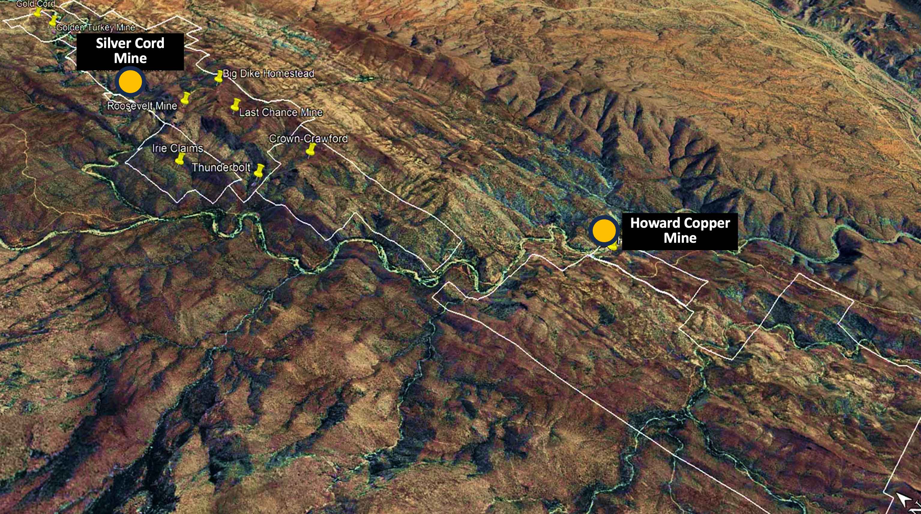
Howard Copper Mine
The Howard Copper Mine has a history of exploration and production, beginning in the late 19th century. The Howard Mine covers 80 acres of patented land in Yavapai County, Arizona. Historical production records (1920’s to 1940’s) indicate that approximately 100,000 tonnes of copper ore with an average grade of between (3%-5%).
King has undertaken a comprehensive technical and engineering survey to establish a baseline undertaking of mine geology and the underground workings. The initial exploration program will evaluate the potential for additional VMS mineralization along strike and at depth.